There are neighborhoods that cross the Dorchester town line including Lower Mills and Mattapan. Lower Mills can mean Dorchester or Milton. Similarly Mattapan is a name that has been applied in the past to both sides of the Neponset River at the Upper Falls. Mattapan also extends across the Dorchester town line into what was once West Roxbury (now Jamaica Plain). In history the name Mattapan probably did not extend as far eastward as it does now after the introduction of zip codes. For the post office the area of 02126 stretches almost to Lower Mills, much further than the name was used traditionally.
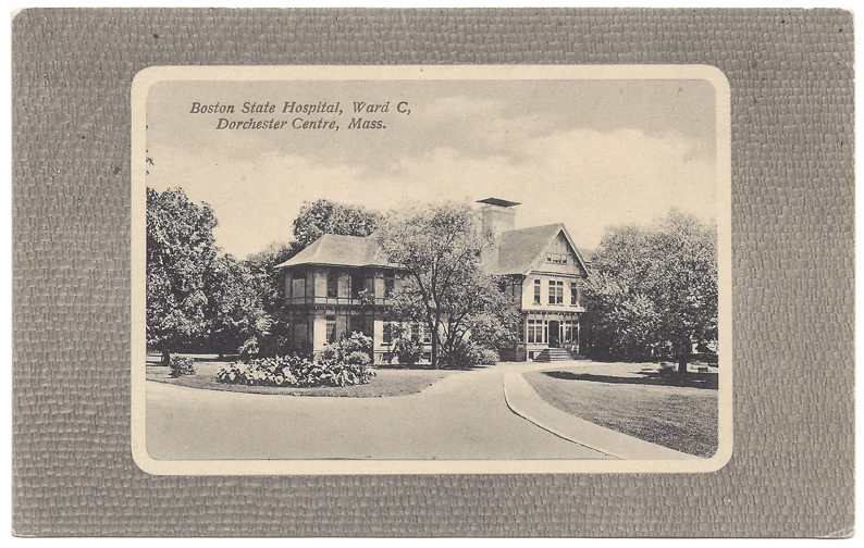
Today we are concerned with the town between Dorchester and West Roxbury (Jamaica Plain). The boundary of the town of Dorchester when it was annexed to the City of Boston in 1870 followed Harvard Street from its intersection with Blue Avenue to its intersection with Cummins Highway. This means that the property where the Boston State Hospital was located is not in Dorchester. Yet there are many historical references even within city records mentioning its location in Dorchester. Today’s illustration is one example of this.
The Boston Lunatic Hospital opened in South Boston in 1839. In 1881, part of the hospital was transferred to the Austin Farm in West Roxbury, although contemporary sources call it Dorchester. In 1898, more of the hospital is moved to the Pierce farm, also in West Roxbury, and later the land in between the farms was added to the institution. In 1908, the City sold the hospital to the Commonwealth of Massachusetts, and the name changed to Boston State Hospital.
Today part of the Hospital’s property has become the Boston Nature Center, part has become the Massachusetts Biologic Laboratory, and part has become a housing development named Harvard Commons.